DE SAINSON, Louis Auguste;
View of Kahuwera, Fortified Village in the Bay of Islands
1833
Lithograph on paper
325 x 495mm

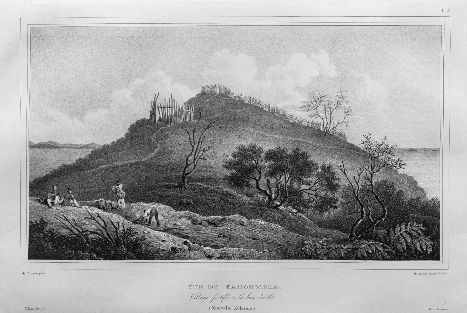
Original title: ‘Vue de Kahouwéra, village fortifié à la baie des îles (Nouvelle Zélande)’. Lithographed by Jacques-Gérard Milbert. Figures by Jean-Victor Adam. Plate No. 51 from Jules-Sébastien-César Dumont d’Urville, Voyage de la corvette l’Astrolabe exécuté pendant les années 1826–1827–1828–1829 (Paris: J. Tastu, 1833). Other lithographs from the series can be viewed here.
The following text comes from the catalogue for the exhibition Tirohanga Whānui.
Having climbed up from the sandy bay below, crew members of the Astrolabe are collecting cabbages while de Sainson with his block of drawing paper and another look on.
Behind them the fortified pā of Kahuwera rises up, its palisades and the rooflines of whare visible though it had been long abandoned. Behind its steep site the islands of Moturoa and Motuarohia stretch out across the Bay of Islands. An enemy’s seaward approach to Kahuwera would have been difficult if not impossible.
In 1937, the historian Leslie Kelly visited the area trying to locate the precise viewpoints shown in these lithographs. He described how ‘the headland of Kahuwera was conspicuous by high cliffs approaching 200 feet in height and which, even from a distance, could be observed to have been cut into a series of short terraces resembling gigantic steps down the steep side’.

Exhibition History
Tirohanga Whānui: Views from the Past, Te Kōngahu Museum of Waitangi, 15 April to 15 September 2017